Tuesday, August 30

Home at last


It is nice to finally be home, there have been many things that we have missed in the last 3 months – the benefits of a routine and some structure, so easy to take for granted until you don’t have it. Not to mention a job and some income! It is also kind of sad to finish the trip off. It has been a phenomenal experience, I feel lucky that I have been able to do this. We live in a beautiful country, populated by excellent people. There is so much geographical diversity, and plenty of regional personalities, but underlying it all we found much commonality in the people we met.

I hope this blog has been interesting to follow, and maybe a bit useful for anyone considering such a trip. It has been fun to keep up, and knowing that some of our friends, family, and co-workers were following along made us feel a little less alone when we had our tough days. So thanks for reading!

Saturday, August 27

August 27 – Osoyoos to Victoria

We caught the 5PM ferry over to Vancouver Island today – but almost had the day spoiled by BC Ferries. We arrived at the terminal around 2:30 but the 3 was full. There was no 4PM ferry (Saturday in August?) but fortunately I had reserved for the 5PM so we were OK. I heard later that most of the subsequent ferries were cancelled due to mechanical problems. I am glad we made it – it would have been irritating to have to spend a night in the terminal!

It is much less annoying to wait 2 ½ hours in the van as opposed to a normal car. While we waited, we made lunch, and popped up the top so we could relax. The car that pulled up beside us were pretty jealous – they used to own a VW van too! One of the people in the car was visiting Vancouver from Manitoba – we had passed less than 10km from her house. Given Canada’s population distribution, I guess this is not surprising. It is cool that we can expect to run into many people who live close to our route in the future, it makes us feel connected to our fellow citizens.

Thursday, August 25

August 25 & 26 - Osoyoos

Bike log (25th): 59.9km, 1098m of vertical, avg. speed 26.2km/h
Bike log (26th): 50.5km, 721m of vertical, avg. speed 27.3 km/h

After traveling so far and for so long, it is really nice now to realx for a few days and hang out at the beach! It feels like holidays, as opposed to a journey. It is nice and hot, (30 degrees), and we spent some time hanging out at the beach of our campsite.

This morning (25th), before it got hot, I rode up (then back down) Anarchist Mountain, which is on highway 3 going east from here. It is a tough climb, but I think Kootenay pass was a little bit tougher. Kootenay pass has a bit more vertical ascent, and also does not have any real flat spots to catch your breath. Anarchist Mountain throws the worst at you right from the start – the steepest section is the first 18km or so. After that it is less steep, and goes on for another 12km of rolling ups and downs to the summit. Still a tough climb, but it seems a little easier now than when I came through the first time!

On the 26th, I rode the other direction, up, over, down, and back up the hill which is on the westbound highway. This is a section of the Penticton Ironman, which is taking place in 2 days. There were a quite few Ironmen (and Ironwomen) out today, checking out the hill. Definitely not as hard a hill as some of the mountain passes but I think it would be pretty tough in the middle of that huge race. Hats off to those incredible athletes!

Wednesday, August 24

August 24 Moyie Lake to Osoyoos

Bike log: 42.0 km, 1181m of vertical, avg. speed 20.4 km/h

We are in the home stretch now. I am glad that we ended up with a few spare days at the end of the trip because we can relax and enjoy things somewhat now. It was not a lot of driving to do today as we have been planning on staying in Osoyoos for quite some time – one of our favourite vacation spots.

The short distance today meant I could cover some of it by bicycle! On the way east through this area, we headed up through Nelson, which meant that we bypassed highway 3 from Castlegar to Creston. This is where Kootenay Pass is, which is the highest pass in the Rockies (1774m elevation). So being the sucker for hills that I am I biked from Creston to the summit this morning. Cheryl waited for me at the top, and we drove down the far side. I did not ride down as it was still a little chilly up at the top - coasting for 45 minutes or so at 40-50 km/h would have been cold! But I did check out the road coming up the east side as well. There was not much traffic, and there is a decent shoulder the whole way, with a passing lane in all the steep sections. All in all, good riding conditions. It is a tough hill going either way. Going west, it saves the hardest (steepest) part for the end. Going east looked to be slightly harder. The westbound uphill section lasts about 35km, and the last 10 or so is where it gets steep – 8% grade pretty much the whole way, with no flattening out anywhere to catch your breath. But unlike most of the passes there is a really nice rest stop at the summit where you can pull out and rest, and put on some warmer clothes for the descent!

It slowly warmed up the whole day. It was cold and wet in Moyie Lake when we left, but by the time we hit Castlegar it felt like summer was back. Finally, coming into Osoyoos, it was hard to imagine that we had been chilly – it was about 28 C when we pulled in here around 5 PM. The forecast is good, so we have decided to stay here until Saturday and then complete the trip home.

Tuesday, August 23

August 23 – Calgary to Moyie Lake


What happened to summer? It was really cold today, from beginning to end. Calgary was forecasted to have a high of 12 degrees today, and I doubt it had hit that by the time we left. It got colder as we left – climbing up into the Rocky Mountains – and also started to rain. I check a thermometer at a gas station at around 3PM and it said 6 degrees, and the attendant told me that it was snowing in Golden, just up the road from where we were. I was not surprised! Two days ago we were sweltering and now it feels like summer is over.

Our route today was to take the Trans Canada highway through Banff, and then highway 93 & 95 south through Cranbrook, and stay the night in Moyie Lake Provincial Park, which was a really nice place that we stayed in on the way out. Once we hit Cranbrook we will be back onto highway 3, the same route we took heading east. This is one of our favourite parts of the province, especially in the summer.

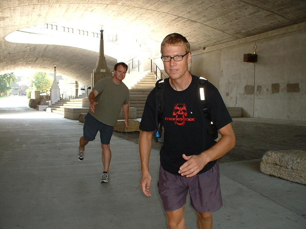
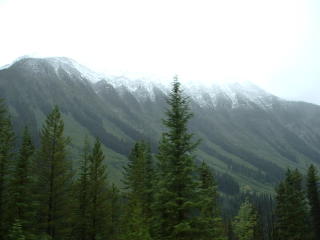
We stopped in Banff to have lunch and see the town a little bit. The mist obscured the mountains a little bit but it did not detract from the awesome beauty. Unfortunately the van was not too happy with the cold and wet. It stalled, then flooded, just as we were planning to leave, so we got stuck there for an extra couple of hours waiting for the flood to clear. There certainly are worse places for that to happen!

It is great to be back in the mountains and BC again. I have almost forgotten how big and impressive these moutains are. The Rockies are perhaps the most stunning part of the whole trip for me. Nothing subtle about the beauty here. Going through the mountains of northern Ontario and Newfoundland was very beautiful as well, but the sheer size of these mountains puts them into a different class. You feel very small looking at them, and the fact that something so huge can exist is difficult to grasp.

Monday, August 22

August 22 Tilebrook PP to Calgary (via Drumheller)


We spent most of the day (other than driving) Drumheller. Very cool place! We have both wanted to come here for a long time, to see the dinosaur (and other) fossils. I was not aware, however, of the striking landscape where the town is situated. It is located in a canyon, in Alberta’s badlands. Layers of sediments are exposed in the walls of the canyons – you can see how this makes it very convenient to go back to previous epochs when fossil hunting!

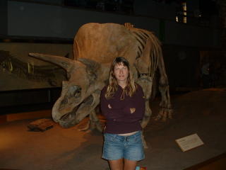
We visited the Royal Tyrell Museum, located just outside of Drumheller. It was a fantastic museum, very well laid out and with excellent fossil specimens not just of dinosaurs but of tons of other life forms that used to live in these parts. It is almost impossible to imagine the world inhabited, epoch after epoch, with such a variety of animals. Also fascinating to think that until the early 1800’s there really was no knowledge of everything that was here before us. Quite humbling really, humans are just a blip on the timeline!

We arrived in Calgary towards evening and briefly explored a small portion of it. It seems like a very nice city – very clean (maybe the wind blows all the garbage away!). Obviously quite propserous as well, as numerous cranes can be seen around the city! We would like to have more time to explore the city but time is getting short, so we will be limited to just a couple of hours tomorrow morning before pressing on. But, after crossing Canada, Calgary now seems so close that I can imagine coming back here to visit!.

Sunday, August 21

August 21 – Rivers to Tilebrook Provincial Park (Alberta)


That was a lot of driving - about 925km in all! But we wanted to make up for the lost day due to the breakdown, so we decided last night that today would be a heavy driving day. I think we have more or less made up for the lost time, of course including the fact that we did not see Winnipeg or Saskatoon.

We passed through the entire province of Saskatchewan today (and an hour or so in each of Manitoba and Alberta). A pretty good chunk of the prairies – zoom! – in one day. It seems pretty incredible to do that after biking through it. I had it in mind that we were going to be spending a bunch of time here. It is strange to make such rapid progress. It is also strange that when we hit the Alberta border I felt we were getting very close to home! Everything’s relative.

The landscape was beautiful, though slightly different than on the way through. It has been around 2 months since we came through and the crops have aged, and dried out! There was a lot more green last time, now it was brown and even golden. I have never seen so much crop land before, so close to harvest time (some was being harvested). I now understand the expression “a sea of wheat” as the tops of the wheat shafts do blur into almost a liquid form as the wind pushes them along, and the little rolling hills form the contours of waves.

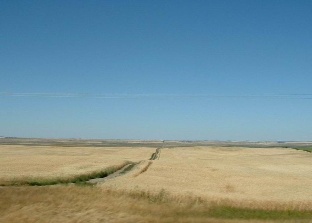
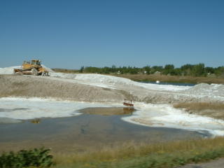
The list of products of this land is quite impressive – we passed through huge sections of wheat, potatoes, canola, cattle ranches, sunflower, and also oil fields, and some salt mines! We also saw a pronghorn (a.k.a. antelope) standing in a field. Too bad he wasn’t moving – they are the second fastest land animal in the world, behind the cheetah.

Saturday, August 20

August 20 – Kenora to Rivers Prov Park (near Brandon)


The folks at Canadian Tire found the problem pretty quickly – a broken fuel line. Someone had previously repaired it with a kludge that eventually gave up for good. I am relieved it was something minor and easily fixed! We were on the road today by about 1:30 and made pretty good progress into Manitoba.

The breakdown cost us more or less one day, and it has caused us to change our plans slightly. We had planned on hitting Winnipeg (last night) then Saskatoon (tonight), but we are now going to bypass both of those cities. It’s too bad, we did want to check them out, but time is starting to get short now. And we are both looking forward to being back closer to home.

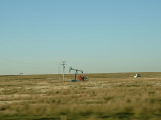
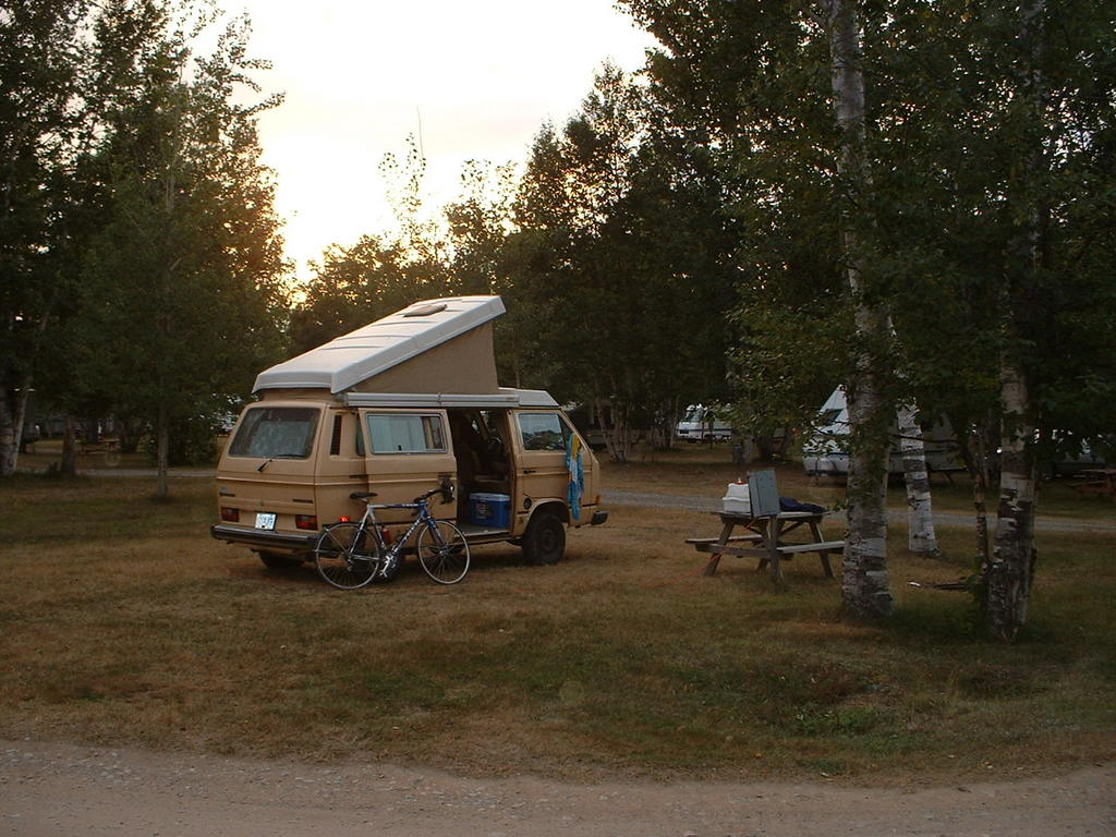
This is a nice provincial park we are in. Quite remote, and there are not many people here. We are right across from the water and it is very peaceful. It is nice to be camping again, after hoteling it last night. I am glad the way things worked out after all.

We are back in the prairies now. It is cool to finally be back here, after so many weeks away. It feels familiar, which is very interesting because before this trip I had never been to the prairies (that I can remember). I am excited about this, it means that to me much of Canada now seems like “mine” - no longer is it a land of vast unknowns.

I am really glad that I was driving and not on the bike because it was a blasting headwind! The sunset tonight was spectacular– we certainly have seen many beautfiul sunsets on this trip but the prairie sunsets can hold their own! So much sky, and meadows of wildflowers too!

I am really glad that I was driving and not on the bike because it was a blasting headwind! The sunset tonight was spectacular– we certainly have seen many beautfiul sunsets on this trip but the prairie sunsets can hold their own. So much sky, and meadows of wildflowers too!

Friday, August 19

August 19 Thunder Bay to Kenora

We got our early start today, with the intention of making it to Winnipeg. However, things played out a little differently! As we were approaching Kenora, the van started running very rough, and then finally it stopped altogether. Yes, it finally happened, we were a broken down Volkswagen van by the side of the highway. However, things could not have been much more convenient for a breakdown. First of all, the van continued to run (or more like limp) until we were able to make it to a campground/gas station, which also, very conveniently, sold beer. So I called CAA, and, knowing the day was over for driving, we cracked a beer and waited for the tow.

We were only about 15km from Kenora, so the tow did not take long. We had not been planning on stopping on Kenora, being somewhat bent now on making progress westward, but the plans changed! The tow truck dropped the van off at the Canadian Tire around 5, so I went in and made an appointment for them to take a look at it first thing in the AM (they were very accomadating). We got a motel right across the street and hit the town! What party animals, we were in bed by about 9:30 (but hey, we lost an hour due to the timezone today).

Kenora really is a beautiful place. I was wondering if it would seem as nice on the way back west as it did coming east, since coming east it was the gateway to the land of lakes and forests, after so much prairie. But it did not disappoint this time through either. After a day of rain, we were lucky enough to get sun while we were waiting for the tow truck to come, and it held until after dinner. We took a walk along the water, and looked out at the boats and islands. Sure looked like summer fun!

Thursday, August 18

August 18 - Rabbit Blanket Lake PP to Thunder Bay


The weather got cooler today, and it rained on and off, so we did not get our last swim in the lake. But it was a good day anyway. It was actually a relief that it was a bit cooler today, driving in the heat is almost as bad as cycling in it! When it is cool and rainy, it is kind of nice to just stay in the van and drive, so we covered some good ground despite a slow morning spent drinking coffee and chatting in the van.

Today’s scenery was really spectacular, just as we had remembered it. There are possibly even more great views going west, although it was a little foggy coming through so maybe we just hadn’t seen them.

The van is quite slow, especially on these hilly, twisty roads. Sometimes I feel bad holding up traffic, although there are enough passing lanes that I don’t think it’s really a problem. But we are back in Thunder Bay, which is possibly where I have seen the worst driving of all the trip, including shoulder passing and trucks passing at high speeds in construction zones right beside the workers. If you look closely in the picture above, you’ll see a white smudge at the edge of the road by the curve. This is what it looked like up close.

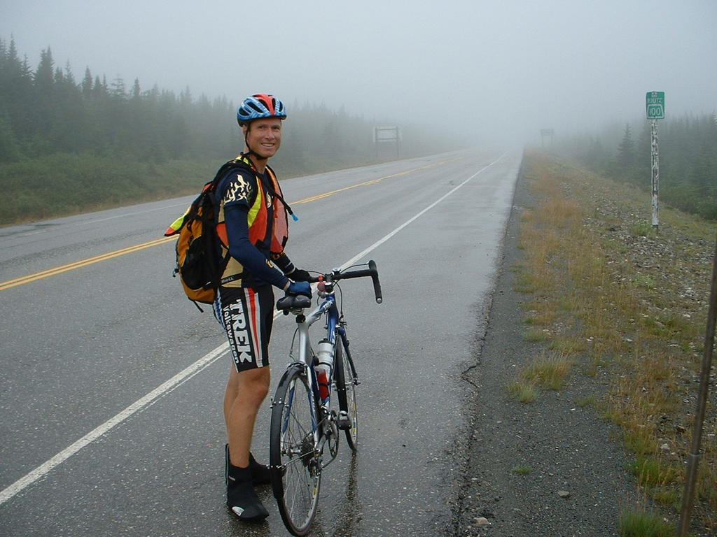
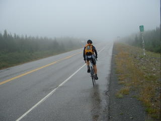
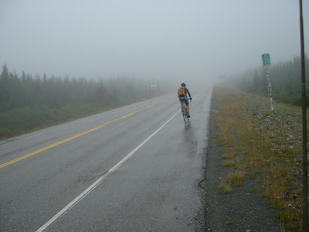
After seeing this, I really didn’t care about holding up traffic – these roads do demand serious attention and caution!

The truck, labelled Maritime-Ontario, was probably full of lobsters, which got loose and into Lake Superior. Hopefully they will help with the eel situation in Rossport, but it was just one more reason to not swim today.

When we came through on the way east, we spent a rest day in Thunder Bay, and now it seems quite familiar! We are staying in the same place and ate at one of the restaurants that we went to last time, and we did not need to consult any maps to get around. Where is our sense of adventure? I think I lost it in a Quizno's around Sudbury where they offered a soup described as "Scrumptuoso."

Wednesday, August 17

August 17 – Chutes PP to Rabbit Blanket Lake PP


Bike log: 36.2km, 470m of vertical, avg. speed 29.3 km/h

For some reason we both slept in this morning til after 8 – very unusual for me! Probably had something to do with being up until 1AM 2 nights ago. Strange that it did not catch up with me until today. So we got off to a bit of a slow start but still managed to cover some good distance. It feels good to be getting so much closer every day. Still a long way to go though – we are not half way there yet!

It was beautiful scenery today – we passed along the north shore of Lake Huron (though we only got a few views of it) and then through Sault Ste. Marie and along the eastern shore of Lake Superior. Lake Superior is definitely one of the scenic highlights of the trip. Today was not as sunny as it was on the way through but it was still spectacular. We stopped at a few places to admire the view. The water was a greenish blue colour, and there were a number of beautiful beaches. There was a reasonable amount of wind, enough to create a few waves, so the water was not as warm as last time, and the air temperature was not compelling enough to coax us in. Maybe tomorrow if it heats up we will get a last dip in Superior.

We stopped driving around 5:30 today – stopping so we could stay within Lake Superior park for the night. It gave enough time to get a bike ride in before dinner. Conveniently, we are right near some of the largest hills along Superior’s shore. So of course I had to ride up and down them a few times. Great ride! In addition to the great scenery, this area was also one of my favourites just for the cycling – as I am a sucker for punishment on those hills. I wish it wasn’t so far away from home, I will miss this area.

Tuesday, August 16

August 16 – Ottawa to Massey (Chutes Provincial Park)


Got some good miles in today, it feels good to be moving west. We spent the first part of the morning visiting with Luke, Catherine, and Nathan, so we did not really get going til nearly noon, but we stayed on the road until about 8 so we covered quite a good distance. The only thing that slowed us down was that we hit about 4 construction zones – we had to wait for about 40 minutes at one of them!

We passed to the north of Algonquin park and had to decide whether or not to detour through it. In the end we decided not to because it would have been a few hours detour, and we were not far enough along to stop for the day, so we just would have been driving through anyway. So best to just keep on moving. Similarly, we did not dip down into southern Ontario at all, instead taking highway 17 straight across from Ottawa, through North Bay to Sudbury.

The drive was pretty unremarkable today, but tonight’s campground is really beautiful – best spot we’ve been in for a while. Nice to be back in the Ontario provinicial parks. There is a really nice waterfall here, pretty large and raging away. There’s also a swimming hole just below the falls. It would be great to be spending a day here, but we don’t have the time. A great vacation would be to drive from around here (maybe starting in Algonquin) and head to Thunder Bay, stopping at several provinical parks for 2 nights – so you have a full day with no driving to enjoy the campground you are in. There are so many between here and there.
Once we passed Espanola (about 30km ago) we were back onto familiar ground – though it doesn’t look too familiar right now. Kind of unremarkable along the road though, it’s not surprising that it did not stick in our minds. Tomorrow should be a really nice day as we pass along the eastern then northern shore of Lake Superior – some of our favourite scenery coming out. We plan to stop at a number of spots along the way.


Once again I am glad about the route we took heading east – heading down into Southern Ontario across Manitoulin island was much more scenic than the stretch we did today. The only part I would have done differently was to head for highway 2 sooner than we did, and avoid highway 7.

Monday, August 15

Ottawa


We spent a day with my friends Luke and Catherine in Ottawa and went for a giant walk along the Ottaw river, to the parliament buildings, around the market, over to Hull, back to the market for lunch, and then home. Very tiring in the heat! I lived in Ottawa nearly 20 years ago for 4 months, but so much of it looked different. Some of it is new but also I have forgotten a lot. It is was cool to walk along the river, oblivious to the city above and then come up the stairs at the locks and be in the middle of the city!

Sunday, August 14

August 14– Montreal to Ottawa


Leaving the city was not nearly as confusing as getting in, and the drive to Ottawa was once again the old Trans-Canada. It only took about 2 hours.

We hung out with my old friends Luke and Catherine, along with them and their son Nathan. Nathan is about 5 now and it is the first time I have met him. He is very talkative and funny! I showed him around our van and he was really into it, as it seems so many kids are. Although small for an adult, all the little cupboards and kitchen appliances are perfectly kid size, and the upper poptop seems like a fort.

Saturday, August 13

August 13 – St. Andre to Montreal


We intentionally bypassed Montreal on the way out, but it was a planned highlight of the return trip. We got in a bit later than we had planned – we kind of got lost trying to find our hotel and before we knew it a couple of hours had passed! By the time we got settled in here, it was dinner time, so we headed to Weinstein and Gavino’s, where we had been with my parents on Cheryl’s 30th birthday. Fun place! We wandered around a bit along St. Catherine’s st. as well, but it was getting dark and we were both tired, so we packed it in early.


Montreal sure feels like a different country! It is extremely multicultrual compared to everywhere else we’ve been. I think it is one of 2 “great” Canadian cities that are world class, Toronto being the other. Montreal is more exiciting in many ways than Toronto, however. It would not be hard to spend a week here just visiting different parts of the town, checking out some museums, old town, etc.


Our hotel has a great view – we are on the 25th floor. It has a view of the train station, and I have counted many passenger trains going in and out. It is nice to know this is still a form of public transport in some parts of our country! It is a tribute to times gone by, when efficiency really mattered in transport, not like now when gas is so cheap that people can afford huge guzzlers just to commute. I suppose this is why engineers are fascinated by trains.

It looks like much of old Montreal that has been neglected is getting restored now. As with many cities, it seems, the downtown core is being rediscovered, and it is a trendy/expensive place to live. Funny how things go in patterns! Old Montreal was a bit bigger than I thought it would be, and due to the fact that much of the rest of downtown Montreal has old buildings as well there is a gradual change from the old town into the city.

Friday, August 12

August 12 – Moncton to St. Andre (just west of Riviere-du-Loup)


Bike log: 53km, 123m of vertical, avg. speed 32.5 km/h

Bike log? Yep! Moncton to Montreal is too long for 1 comfortable day of driving, so we split it into 2 medium days. It was about 6 hours of driving, and so we got here at a comfortable 4:30PM – plenty of time for a good bike ride! I snacked and was on the road in about 10 minutes and made it to Kamouraska and back.

It was great to be back on the bike again, after 4 days off. I also enjoyed the fact that this was not part of the trip, so I could go as hard as I wanted without worrying about getting a cramp or burning myself out or wearing my legs out for tomorrow.

Our campsite last night was near “Magnetic Hill”. It is a tourist trap where giant magnets suck all the change out of your pocket if go in. We avoided it like the plague.

The drive was pretty standard fare for the Trans-Canada. At the end of the day we passed the spot where we backtracked, so essentially today we saw what we missed. I am glad we took the route we did, this way was not very scenic, and of course it was very busy, being the Trans-Canada. There were some secondary roads that followed more closely to the St. John river, I bet they would have been nicer (essential in some places since there were 2 bridges that forbade bikes), but still I liked the parts of the New Brunswick coast that we saw more, as well as the more scenic route north of Riviere-du-Loup and cutting across the Gaspe. However, there is an unpaved bike trail (old railbed) that parallels much of the route we took today. No doubt nice grades and decent scenery. It would not have worked for us since we like to take the identical route, but it would be the way to go if you were cycling alone.

Along the way we passed the world’s longest covered bridge, over 1200 feet. Why is the cover so important? I don’t know.

Thursday, August 11

August 11 – Halifax to Moncton

The hotel we were in had a 1PM checkout time, so we took advantage of it. I hiked up to the Citadel again. Very cool, although it was even more impressive last night, with fog rolling in and eerie lights shining out from inside.

I am sort of feeling like I am going through a bit of a post-bike-trip withdrawl. I really miss riding, maybe not huge rides every day, but I would like to get some regular riding in. So far our schedule has not allowed for it. I want to get some decent driving miles in though, and feel like we are making some progress back home, so it is hard to find an hour or two in the day for a ride. Well, maybe tomorrow, if we get a decent early start, I can get some riding in along the St. Lawrence river – we plan to hit Riviere-du-Loup tomorrow.

Inexplicably, the Rolling Stones are playing in Moncton on September 3.

Wednesday, August 10

Not so tiny Bubbles


Possibly the highlight of the trip back so far has been seeing a large mural of Bubbles. Trailer Park Boys is filmed near Halifax, maybe in one of the campgrounds we stayed in.

Halifax


Halifax was very fun to see. It is not too big of a city, just a little bigger than Victoria. Lots of restaurants and pubs, and an touristy harbour walk full of people and buskers just like Victoria. There are some really loud buskers though, kind of irritating. And I have not grown any more fond of the bagpipes here in the maritimes.

We went up to the old citadel at the top of the hill. Whereas in Quebec you could crawl all over it, in Halifax they wanted you to pay to enter. Seems like a shame to pay for something that is part of our national heritage! Still, the citadel was impressive (we saw it at night as well, with a mist rolling in and eerie lights coming from within) and it gave great views of the city and the harbour. I read that Halifax was never attacked, and you can see why – what a great defense with the citadel on a hill and little islands in the harbour to put a fort on.

August 10 – Ferry ride / Drive to Halifax


Again, not too long a distance, but it sure felt long! We arrived in North Sydney around 5AM. After a short drive to find something to eat in town, we hit the road, taking the “other route” across Cape Breton (Highway 4). It made me glad we took the north side, the Trans-Canada, on the way there. Highway 4 was narrow with no shoulder, and the pavement was in bad shape.

The ride over was not bad – not rough at all. The sleeping berths were fine, though not as nice as a cabin! Around 10 we pulled off in a rest spot and popped up the top of the van for a rest – it was great! Probably we’ll be doing more of that.

We are both looking forward to getting some good miles behind us. After so long on the road, it will be nice to be heading west. It is still very enjoyable to be traveling, but just getting closer to home is good.

Tuesday, August 9

August 9 – Badger to Port-aux-Basques


Not too long of a drive today, but we were retracing our steps from just a few days ago, which made it seem tough in places. It’s always harder to drive over familiar terrain than something brand new. There was one notable hight point, though, as we were driving along, I spotted a cyclist coming towards us, and soon realized that it was Ryan, who I have met now 3 times on the road! He is biking across Canada, and did both the Cabot trrail and is now biking across Newfoundland. We wheeled the van around and met up with him. I think he was as surprised to see us as we were to see him. He is gunning it across Newfoundland, trying to make it in 5 days, I believe.

We finished up our tour of Newfoundland by arriving at the ferry around 6, with nearly 6 hours to kill in Port-aux-Basques before the ferry left. We cooked dinner in the ferry terminal and lamented the fact that we couldn’t just stay in the van on the ferry, once again! After dinner, we wandered around the town a bit. It was quite full of people this time, unlike the last time we were here (due to us leaving rather than coming no doubt). Although it was quite warm when we were driving today, as we sat in line a thick fog rolled in and it eventually became quite cool. Definitely what I expected from Newfoundland!

We have sleeping berths on the ferry tonight, no cabins, so we should get some sleep. But still, the crossing is just 5 hours so it will be a long day tomorrow.

Monday, August 8

August 8 – St. John’s to Badger


Am I bored with biking? Do I never want to see another hill again? Nope! I got up and first thing this morning I went for a bike ride! I did not have that much time, so I went for a hill workout. A local had mentioned that signal hill was quite a climb (in fact she suggested walking my bike up it…). So I did that 5 times. Good workout, it is nearly as tall as Mt. Doug (130m), and steep in places, although it flattens out in sections so you can catch your breath. By the fifth ride I had figured it out pretty well and could maintain good speed all along it. Fun to have a new hill to do that on, I am so familiar with the climbs around Victoria that they get a bit boring.

There were really spectacular views from the top of signal hill. Also a bit of history of the place was listed on some plaques. I was not aware that it was torpedoed (no damage) in WWII. There were great views of the wide open Atlantic, good views of the harbour, and also city views.

We were on the road around 1:30 or so, and covered about half of the drive over to Port-aux-Basques – around 450km. We move much faster now! However, I was surprised at how long it still takes to cover significant distance. We passed a few of the ‘rest places’ from the last ride, and I was surprised at how long it took to go between them. When I was riding, I had imagined that Cheryl almost instantly was transported to the next rest stop, usually between 25 and 40km down the road. Obviously not the case! Also, much of the road looked pretty daunting when viewed from the van. I imagined riding it and thinking that it looked like a long way, or that the hills looked big. Much less intimidating on a bicycle for some weird reason. Good lesson – driving a road before a bike trip is not necessarily a good idea as you might scare yourself out of it!

We did not get a chance to do even a quarter of the things we wanted to around St. John’s, and no doubt tomorrow will be a bit pressed for time as well. As with many places we’ve been to, it is not hard to imagine coming back at some point in the future when there is more time to really explore a place.

Our campsite is right on a lake. This feels like one of the most remote places we have camped. They were sold out of sites, and the overflow area is down near the boat launch. That is just fine, because there are lots of noisy people in the campground, but it is nice and quite down here. Incredible display of stars! Also, there are so many planes flying overhead. We are not far from Gander, which used to be an improtant airport (as a last refueling spot) before jets could make it to Europe in one go. I guess it’s still more or less on the way.

Saturday, August 6

Flags


We got this photo one day in New Brunswick – it was a good opportunity to get the flags of Canada and all the provinces (and territories too). A nice windy day too, to fly the flags, and it was going the right direction!

Some wrap-up stats. The trip here was 7154km long, included 39,480m of vertical ascent, and took 67 days. We took 11 rest days, 1 sick day, and 4 or 5 short riding days. In all, I peddled for 251.7 hours at an average speed of 28.4 km/h. There were 29 days of mostly headwinds, 15 days of mostly tailwinds, and the rest were mixed or calm. We went through 8 major construction zones and 4 and a half time zones. We traveled through 20% of the longitude of the earth.

The trip back will be much faster, but far from instantaneous in a van that doesn’t like to do more than 95 km/h! We plan to try to see a few of the things and places we didn’t get a chance to see on the way here, and I plan to keep updating this journal from time to time with the things we see.

Celebration!


People in Victoria may recognize this as a bottle of IPA from Swan’s. No, it is not for sale here, but instead we ferried it here in the van. Appropriate, since it was a gift from the “beer fairies” back in Victoria. There were 2 bottles presented to us for good luck when we left. The first was consumed at the halfway point, and the second, well, it won’t make it through the night!

We have 3 more days in Newfoundland until our ferry reservation (we can make those kinds of things now) and plan to spend a day in and around St. John’s and then start heading back to Port-aux-Basques (the Argentia ferry is still fully booked). We're looking forward to it - it's a really cool looking town!

End of the road


The weather slowly improved throughout the whole day, and by the end it was a beautiful summer day. There are 2 main ways to do the last little bit into St. John’s – follow the Trans-Canada or else take highway 2. We took the Trans-Canada, assuming it would lead to the fabled “Mile 0” marker. However, it more or less just petered out, unceremoniously passing by a landfill site and then into a residential area, no longer a highway but now just a plain old street. But at last the road ended at a T-junction and we had water!

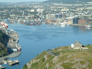
We could not find any sort of indication that this is the start (or end) of the road, but we were sure we had arrived at it. Later, we found that we had overshot St. John’s by a few kilometres, and this was in fact not the ocean but a small lake. Also, the “Mile 0” marker is nowhere near the end of the Trans-Canada highway but is instead tucked away fairly obscurely downtown. But fortunately there is no official rule book on where you have to stop or start, and this was a really beautiful place to stop and take some photos! So we took some of us, along with the vehicles that got us here. And so it is the end of the trip east for us.

Misty vision


It was a very hilly ride in – in fact, today takes 3rd place in terms of vertical for the whole trip. Only the biggest mountain passes in BC involved more climbing. I was really loving it though, I am glad it was a challenging ride to end it up, especially with the huge tailwind pushing me along. I did not really want the ride to end (in some ways), and I was glad to see the hills keep coming to delay the inevitable finale. Even the misty, rainy weather could not put a damper on things, although it made it hard to dodge potholes as I could not wear my glasses!

Camping near Argentia


We arrived fairly late last night – around 9PM – and stopped at a motel near the ferry terminal to get a room. However, they were fully booked up. But the lady at the desk was so nice, she phoned around to a number of places she knew of in the area (not listed in our tourist guide book of course), trying to get us a place to stay. Everyone was booked up, so in the end the lady let us set up camp in their parking lot for the night, and left the lobby unlocked so we could use the public bathroom. That's Newfie hospitality!

August 6 – Argentia to St. John’s (the end!!)


Bike log: 141.0km, 1329m of vertical, avg. speed 31.2 km/h

What a great day, a fantastic way to finish this bike trip! I started from the ferry terminal at Argentia (seemed like as good a starting place as any) and biked in to St. John’s. At the terminal, the wind was absolutely blasting into my face, I thought it was going to be a really long day. It was also quite cold, foggy, and raining. A proper Newfoundland day, I suppose! I was really relieved when the road did a big turn just a few kilometres along, and the wind was at my back – and stayed there for pretty much the whole day! The road was also pretty good, although there were some nasty potholes that needed avoidance along the highway theat lead up to the Trans-Canada.

Friday, August 5

Wintry light


As the day wore on we got some clouds, which turned to rain at night, and the wind started picking up. It got pretty chilly too, for the summertime. The sun hardly had a chance against those wintry looking skies!

Not so familiar terrain


Some of the terrain looked really exotic and foreign. No trees growing anywhere, and there were big boulders lying about and little lakes. Perhaps it is too cold for tree to grow in some places – it felt like we were going above the treeline. What an incredible place – scary and beautiful at the same time.

Newfoundland from the Trans-Canada


Another day where it was difficult to know where to point the camera! The drive from Port-aux-Basques to Argentia was about 800km long, and took us through some really remote parts. I am glad we saw it. It would be quite a bike ride – the road was really good for the most part, with a good shoulder, and the traffic was light (although people were speeding pretty badly). It was extremely hilly, and the wind was very strong in places. We definitely didn’t have the time to do it on this trip!

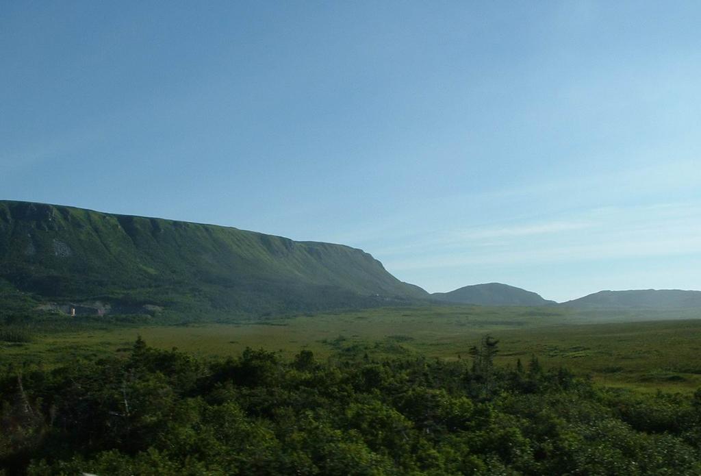
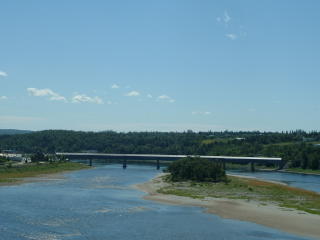
The mountains were a decent size – although it looked like the tops of them had been chopped off or something. In BC you would expect the mountain to just keep going up, but here they ended just as they got going. It also appeared that the mountains were too steep or else the weather was too fierce to allow much vegetation to grown on them. Sure looked cool!

As in a few other parts of the country, like northern Ontario, there were lots of little lakes all along the road. We saw many cars pulled over to the side and people out fly fishing. Cheryl commented that her dad would love it, too bad it’s so far from home!